
New device could help badger-proof flood defences
British Geological Survey (BGS) scientists have trialled a new way of detecting animal burrows in clay flood embankments.
The UK has over 7500km of embankments along its rivers and streams, protecting the communities and infrastructure behind them.

New device could help badger-proof flood defences
But these vital flood defences can be weakened when burrowing animals like badgers, rabbits and now beavers move in and weaken their structural integrity.
When that happens, embankments are more likely to fail during a flood and leave the locations they protect vulnerable to flooding.
Detecting badgers with electrical resistance
Until now, regulators and landowners have had no way to know where the badger burrows go underground and if the burrows have caused significant damage to the flood embankment.
Adrian White, a geophysicist from BGS, and his colleagues trialled a new technique on an embankment on the River Ouse, North Yorkshire, which protects Cawood, a village of 1500 people, from flooding.
White said: “There have been several cases where badgers and other animals have caused embankments to fail, and it can happen very quickly if the burrows are in critical areas of the embankment.
“Badgers are a protected species, so once they’ve been spotted at an embankment it can take months to deal with the problem. The burrows must be found, the badgers moved on, and then the site has to be repaired. And there’s always the risk they could move 100m down the road and find a new embankment to burrow into.
“The whole process takes months, is expensive and labour intensive, but we only find out if the burrows have damaged the embankment once the repair work starts .”
Advantage for clay embankments
Currently, ground penetrating radar (GPR) is used by scientists and consultants to map underground voids.
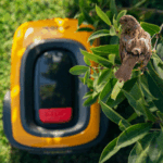
White said: “We trialled Electrical Resistivity Tomography (ERT) on the embankment. Similar to GPR it’s not invasive, we just insert electrodes into the ground that reach about 10cm into the soil.
“The ERT could detect badger burrows up to 1.5m deep in the clay, and map the structure of the badger sett, which had multiple entrances.
“It clearly outperformed the GPR, which doesn’t work very well on clay-rich ground, because the clay absorbs the radar waves.
ERT works by passing an electrical current between the electrodes inserted into the ground and measuring the voltage difference between other electrodes. The system allows the scientists to map the electrical resistance of the soil. The burrows are filled with air, which is very electrically resistive, so the burrows show up as resistive anomalies in ERT surveys.
ERT is a widely used technique and is already used to map subsurface geology and identify archaeological structures.
White said: “This is great news for the agencies and managers in charge of monitoring and repairing flood embankments – it can quickly assess stability, reduce repair costs and minimise the likelihood of unexpected failures during flood events.
“And, critically, it doesn’t disturb the animals.”
The UK’s flood embankment inventory
The UK has built flood embankments over hundreds of years, and they play a critical role in our flood defence in rural and urban areas. In England and Wales, the Environment Agency maintains most, but landowners and farmers maintain some informal embankments.
White said: “Burrowing animals like badgers and the thing that can most rapidly change how well an embankment can hold a flood back. One day there can be nothing and the next, a whole load of tunnels.
“It’s a huge challenge and we must find better ways to mitigate the impact of our wildlife on what will be the last line of defence for some communities.
“Recently, beavers have started to recolonise UK rivers, and it is hoped they will help reduce flooding. What is less well-known is that they are excellent burrowers. These burrows start below the water, so may undermine flood defences without us knowing they are there – we’ll need new techniques to find and map those too.”
White’s research is published in the journal Engineering Geology. Read the full report here: https://doi.org/10.1016/j.enggeo.2023.107198
For the latest industry news visit landscapingmatters.co.uk/news
Get all of the big headlines, pictures, opinions and videos on stories that matter to you.
Follow us on Twitter and Instagram for fun, fresh and engaging content.
You can also find us on Facebook for more of your must-see news, features, videos and pictures from Landscaping Matters